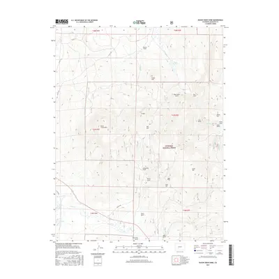
2016 Map of Razor Creek Dome
USGS Topo · Published 2016About this map
Razor Creek Dome rises as a central topographic landmark within this section of the Gunnison National Forest in Saguache County. The landscape is defined by a series of named gulches and high-altitude parks, such as Mill Park and Lower Park, which historically served as vital grazing and transit points for high-country ranching operations. The drainage network is particularly dense, with Razor Cr and Prosser Cr feeding into the Vouga Reservoir.
Find a feature on this map
39 named features on this map. Tap any name to fly to it.
Don’t see what you’re looking for? This feature index may not catch every label — zoom into the map to look around manually.
Map Details
Editions of this 2016 Razor Creek Dome Map
This is the sole edition of this map. No revisions or reprints were ever made.
Other maps of this area

1956 · Montrose
USGS Topo · 1:250,000

1959 · Montrose
USGS Topo · 1:250,000

1960 · Montrose
USGS Topo · 1:250,000

1962 · Doyleville
USGS Topo · 1:24,000

1962 · West Baldy
USGS Topo · 1:24,000

1962 · Iris
USGS Topo · 1:24,000

1962 · Houston Gulch
USGS Topo · 1:24,000

1962 · Razor Creek Dome
USGS Topo · 1:24,000
1962 · Sawtooth Mountain
USGS Topo · 1:24,000
1965 · Cold Spring Park
USGS Topo · 1:24,000