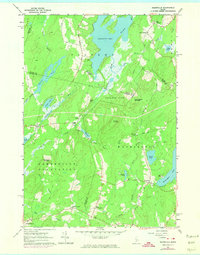
1961 Map of Razorville
USGS Topo · Published 1974About this map
Hibberts Gore, a famously tiny unincorporated area, lies at the heart of this landscape where Waldo, Lincoln, and Knox counties converge. The terrain is defined by a dense network of small ponds and winding streams, including the north-flowing Sheepscot Pond and the Sheepscot River, which passes through Somerville. Further south, the Somerville Plantation represents the era’s rural organization, with small crossroads like Sandhill Corner and Razorville serving as local focal points.
Find a feature on this map
59 named features on this map. Tap any name to fly to it.
Don’t see what you’re looking for? This feature index may not catch every label — zoom into the map to look around manually.
Map Details
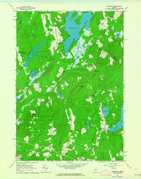
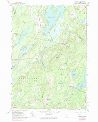
Editions of this 1961 Razorville Map
3 editions found
Other maps of this area

1893 · Vassalboro
USGS Topo · 1:62,500

1893 · Wiscasset
USGS Topo · 1:62,500

1898 · Vassalboro
USGS Topo · 1:62,500

1913 · Waldoboro
USGS Topo · 1:48,000

1915 · Waldoboro
USGS Topo · 1:62,500

1916 · Liberty
USGS Topo · 1:62,500

1941 · Waldoboro
USGS Topo · 1:62,500

1941 · Vassalboro
USGS Topo · 1:62,500

1942 · Liberty
USGS Topo · 1:62,500

1943 · Vassalboro
USGS Topo · 1:62,500