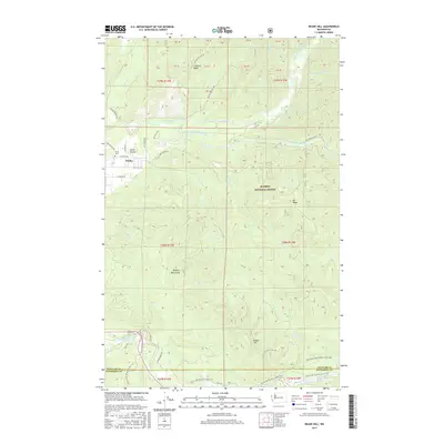
2017 Map of Reade Hill
USGS Topo · Published 2017About this map
Forks Prairie and the township of Forks anchor the northwest corner of this coastal Washington landscape, where the Olympic Peninsula's dense river networks converge. The map documents a complex drainage system including the Calahaw River and its various forks, alongside the winding Bogachiel River which marks the transition into the Bogachiel Rain Forest Wetland to the south. This area is defined by its dramatic elevation changes, rising from the river valleys to Calahaw Ridge and the Olympic Mountains. Significant conservation and recreation footprints are visible through the Olympic National Forest and the Pacific NW National Scenic Trail. For those tracing local history, the Forks Cem and named high points like Reade Hill and Elk Ridge provide essential geographic context for this timber-rich region as it appeared in the late 2010s.
Find a feature on this map
52 named features on this map. Tap any name to fly to it.
Don’t see what you’re looking for? This feature index may not catch every label — zoom into the map to look around manually.
Map Details
Editions of this 2017 Reade Hill Map
This is the sole edition of this map. No revisions or reprints were ever made.
Other maps of this area

1922 · Pysht
USGS Topo · 1:62,500

1935 · Lake Pleasant
USGS Topo · 1:62,500

1939 · Forks
USGS Topo · 1:62,500

1942 · Pysht
USGS Topo · 1:62,500

1942 · Lake Pleasant
USGS Topo · 1:62,500

1943 · Spruce Mountain
USGS Topo · 1:62,500

1943 · Copalis Beach
USGS Topo · 1:250,000

1951 · Copalis Beach
USGS Topo · 1:250,000

1953 · Cape Flattery
USGS Topo · 1:250,000

1956 · Spruce Mtn.
USGS Topo · 1:62,500