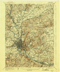
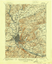
1915 Map of Reading
USGS Topo · Published 1938About this map
Neversink Mountain and the Schuylkill River anchor this 1913 survey of Berks County, revealing the intricate industrial and social geography surrounding Reading. The landscape is a network of water and rail, where the Schuylkill Canal and the Schuylkill Division railroad run parallel through the river valley. The city’s expansion is marked by civic and recreational landmarks like the County Farm, the Fairgrounds, and Carsonia Park.
Find a feature on this map
160 named features on this map. Tap any name to fly to it.
Don’t see what you’re looking for? This feature index may not catch every label — zoom into the map to look around manually.
Map Details
Editions of this 1915 Reading Map
6 editions found

Other maps of this area

1889 · Pottsville
USGS Topo · 1:62,500

1891 · Pottsville
USGS Topo · 1:62,500

1894 · Reading
USGS Topo · 1:62,500

1902 · Boyertown
USGS Topo · 1:62,500

1902 · Wernersville
USGS Topo · 1:62,500

1902 · Slatington
USGS Topo · 1:62,500

1905 · Honey Brook
USGS Topo · 1:62,500

1906 · Phoenixville
USGS Topo · 1:62,500

1906 · New Holland
USGS Topo · 1:62,500

1907 · Honeybrook
USGS Topo · 1:62,500