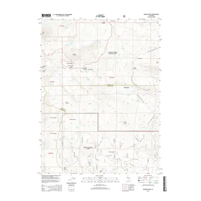
2015 Map of Reading Peak
USGS Topo · Published 2015About this map
Lassen Volcanic National Park dominates this landscape, showing a high-altitude wilderness shaped by active hydrothermal systems. At the heart of the terrain, Reading Peak and Lassen Peak overlook a network of alpine basins including Dersch Meadows and Upper Kings Creek Meadow. The sheet highlights the unique geothermal features that define this volcanic range, specifically the steaming vents and mud pots of Bumpass Hell and Devils Kitchen. Geologic activity is further evidenced by the bubbling waters of Boiling Springs Lake and the rare Terminal Geyser in the southeast. Historical access to the area is centered around the guest ranch at Drakesbad, situated along Hot Springs Cr. This survey documents the intersection of three counties—Shasta, Plumas, and Tehama—as they meet amidst the peaks and high-country meadows of the southern Cascades.
Find a feature on this map
65 named features on this map. Tap any name to fly to it.
Don’t see what you’re looking for? This feature index may not catch every label — zoom into the map to look around manually.
Map Details
Editions of this 2015 Reading Peak Map
This is the sole edition of this map. No revisions or reprints were ever made.
Other maps of this area

1886 · Lassen Peak
USGS Topo · 1:250,000

1892 · Lassen Peak
USGS Topo · 1:250,000

1894 · Lassen Peak
USGS Topo · 1:250,000

1935 · Burney
USGS Topo · 1:96,000

1935 · Paynes Creek
USGS Topo · 1:96,000

1939 · Burney
USGS Topo · 1:125,000

1939 · Halls Flat
USGS Topo · 1:125,000

1941 · Mineral
USGS Topo · 1:125,000

1955 · Westwood
USGS Topo · 1:250,000

1956 · Lassen Peak
USGS Topo · 1:62,500