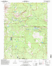
1995 Map of Reading Peak
USGS Topo · Published 1998About this map
Geothermal activity and high-elevation topography dominate this survey of the southern Cascades, centered on the hydrothermal features of Lassen Volcanic National Park. The landscape is defined by its volcanic history, most notably the Devastated Area northeast of Lassen Peak, and the active thermal basins at Bumpass Hell Spring and Cold Boiling Lake. The map details the transition from the protected Lassen Volcanic Wilderness into the surrounding Lassen National Forest, showing the intersection of Plumas, Shasta, and Tehama counties.
Find a feature on this map
63 named features on this map. Tap any name to fly to it.
Don’t see what you’re looking for? This feature index may not catch every label — zoom into the map to look around manually.
Map Details
Editions of this 1995 Reading Peak Map
This is the sole edition of this map. No revisions or reprints were ever made.
Other maps of this area

1886 · Lassen Peak
USGS Topo · 1:250,000

1892 · Lassen Peak
USGS Topo · 1:250,000

1894 · Lassen Peak
USGS Topo · 1:250,000

1935 · Burney
USGS Topo · 1:96,000

1935 · Paynes Creek
USGS Topo · 1:96,000

1939 · Burney
USGS Topo · 1:125,000

1939 · Halls Flat
USGS Topo · 1:125,000

1941 · Mineral
USGS Topo · 1:125,000

1955 · Westwood
USGS Topo · 1:250,000

1956 · Lassen Peak
USGS Topo · 1:62,500