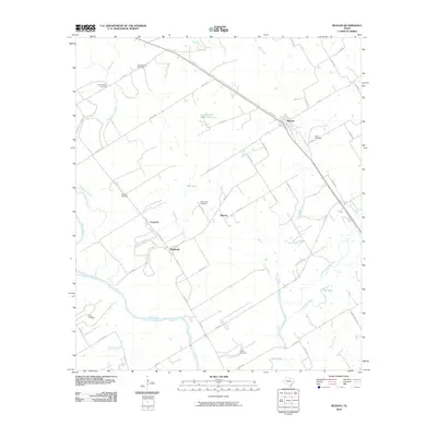
2010 Map of Reagan
USGS Topo · Published 2010About this map
The Brazos River meanders across the southern portion of this landscape, defining the character of Falls County's rural agricultural lands. Small settlements such as Reagan, Beacon, Coymack, and Highbank are connected by a web of county roads and farm-to-market routes like FM 413 and FM 1373. The map is particularly rich in genealogical data, revealing numerous named burial sites including the Old Bowman Cemetery, New Bowman Cemetery, and Facieo Cemetery near the banks of Duck Lake. Tributaries like Big Creek, Mussel Run Creek, and Little Brazos River segment the terrain, creating a complex drainage system that supported the area's development. This survey illustrates the persistent rural patterns of central Texas, where family cemeteries and small crossroads communities remain the primary landmarks between larger river systems and local water bodies like Flag Lake.
Find a feature on this map
55 named features on this map. Tap any name to fly to it.
Don’t see what you’re looking for? This feature index may not catch every label — zoom into the map to look around manually.
Map Details
Editions of this 2010 Reagan Map
This is the sole edition of this map. No revisions or reprints were ever made.
Other maps of this area

1954 · Waco
USGS Topo · 1:250,000

1955 · Waco
USGS Topo · 1:250,000

1957 · McClanahan
USGS Topo · 1:24,000

1957 · Marlin
USGS Topo · 1:24,000

1961 · Baileyville
USGS Topo · 1:24,000

1962 · Rosebud
USGS Topo · 1:24,000

1962 · Hammond
USGS Topo · 1:24,000

1962 · Reagan
USGS Topo · 1:24,000

1962 · Cedar Springs
USGS Topo · 1:24,000

1962 · Bremond
USGS Topo · 1:24,000