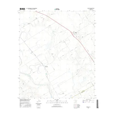
2016 Map of Reagan
USGS Topo · Published 2016About this map
The Brazos River meanders along the western edge of this landscape, defining a wide floodplain characterized by numerous sloughs and seasonal watercourses. Near the settlement of Highbank, the Highbank Slough and Highbank Cr suggest a legacy of river-dependent agriculture and drainage management. To the northeast, the community of Reagan serves as a local hub, situated near the headwaters of Fish Cr. The area is notably dense with small, family or community burial grounds, providing significant points of interest for genealogical research. These sites, including Old Bowman Cem, New Bowman Cem, and Waite Cem, are scattered across the terrain alongside landmarks like Flag Lake and Duck Lake. The transition between Falls and Robertson counties is marked by the winding path of Alligator Cr in the southeast, where the drainage network feeds toward the Little Brazos River.
Find a feature on this map
66 named features on this map. Tap any name to fly to it.
Don’t see what you’re looking for? This feature index may not catch every label — zoom into the map to look around manually.
Map Details
Editions of this 2016 Reagan Map
This is the sole edition of this map. No revisions or reprints were ever made.
Other maps of this area

1954 · Waco
USGS Topo · 1:250,000

1955 · Waco
USGS Topo · 1:250,000

1957 · McClanahan
USGS Topo · 1:24,000

1957 · Marlin
USGS Topo · 1:24,000

1961 · Baileyville
USGS Topo · 1:24,000

1962 · Rosebud
USGS Topo · 1:24,000

1962 · Hammond
USGS Topo · 1:24,000

1962 · Reagan
USGS Topo · 1:24,000

1962 · Cedar Springs
USGS Topo · 1:24,000

1962 · Bremond
USGS Topo · 1:24,000