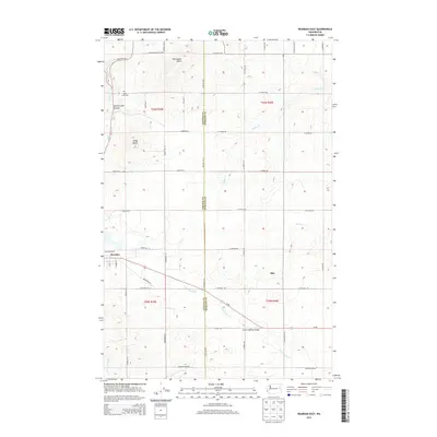
2014 Map of Reardan East
USGS Topo · Published 2014About this map
Reardan and the small settlement of Hite anchor this 2014 survey of the agricultural landscape along the border of Lincoln and Spokane counties. The terrain is defined by the unique geological forms of the Channeled Scablands, featuring prominent landmarks like Shoemaker Butte and Grays Butte rising above the surrounding wheat fields. Local history is etched into the land at the Spring Creek Cem, overlooking the winding Spring Creek Canyon. The map details the drainage patterns of the region, specifically where N Fork Deep Cr and Coulee Cr cut through the plateau. Transportation is a central theme, highlighting the corridor of the Sunset Hwy and the Sunset Highway Bridge, alongside a grid of rural routes such as Euclid Rd E and W Lincoln Rd that have long supported the area's farming economy.
Find a feature on this map
38 named features on this map. Tap any name to fly to it.
Don’t see what you’re looking for? This feature index may not catch every label — zoom into the map to look around manually.
Map Details
Editions of this 2014 Reardan East Map
This is the sole edition of this map. No revisions or reprints were ever made.
Other maps of this area

1943 · Medical Lake
USGS Topo · 1:62,500

1944 · Clayton
USGS Topo · 1:62,500

1944 · Wellpinit
USGS Topo · 1:62,500

1945 · Reardan
USGS Topo · 1:62,500

1950 · Clayton
USGS Topo · 1:62,500

1953 · Reardan
USGS Topo · 1:62,500

1953 · Wellpinit
USGS Topo · 1:62,500

1954 · Medical Lake
USGS Topo · 1:24,000

1954 · Medical Lake
USGS Topo · 1:62,500

1954 · Deep Creek
USGS Topo · 1:24,000