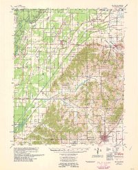
1960 Map of Rector
USGS Topo · Published 1960About this map
Crowleys Ridge rises distinctly above the flatlands of the Mississippi Valley, creating a dramatic geographical divide in this 1958 survey of Clay County. The elevated terrain of the ridge is dotted with rural institutions like Cummings Chapel, Gravel Hill Ch, and the Knob Sch, while the low-lying western plains are defined by an extensive network of drainage projects including Cane Creek Ditch and Ditch No 19. This complex system of flumes and ditches illustrates the mid-century engineering efforts to manage the wetlands between the Black River and the Cache River.
Find a feature on this map
63 named features on this map. Tap any name to fly to it.
Don’t see what you’re looking for? This feature index may not catch every label — zoom into the map to look around manually.
Map Details
Editions of this 1960 Rector Map
This is the sole edition of this map. No revisions or reprints were ever made.
Other maps of this area

1934 · Kennett
USGS Topo · 1:62,500

1935 · Acorn
USGS Topo · 1:62,500

1935 · Rector
USGS Topo · 1:62,500

1935 · Knobel
USGS Topo · 1:62,500

1935 · Harviell
USGS Topo · 1:62,500

1940 · Naylor
USGS Topo · 1:62,500

1940 · Gainesville
USGS Topo · 1:62,500

1940 · Marmaduke
USGS Topo · 1:62,500

1940 · Valley Ridge
USGS Topo · 1:62,500

1940 · Kennett
USGS Topo · 1:62,500