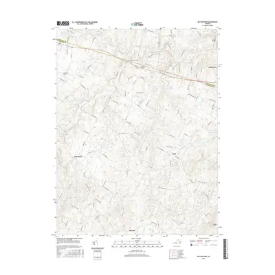
2016 Map of Rectortown
USGS Topo · Published 2016About this map
Goose Creek and its many tributaries, including Panther Skin Cr and Cromwells Run, define the rolling topography of this Northern Virginia equestrian and farming district. The landscape is dotted with prominent estates and historic crossings, most notably the Goose Creek Stone Bridge where Route 50 spans the water near Atoka. This region, split by the Loudoun Co / Fauquier Co line, maintains a traditional settlement pattern centered on small villages like Rectortown and Zulla. To the south, the terrain rises toward Fortune Mountain and Fishback Ridge, overlooking the larger community of Marshall. Local history is preserved in landmarks such as Ivy Hill Cem and the Upperville Airport, reflecting the area's long-standing connection to aviation and agriculture.
Find a feature on this map
100 named features on this map. Tap any name to fly to it.
Don’t see what you’re looking for? This feature index may not catch every label — zoom into the map to look around manually.
Map Details
Editions of this 2016 Rectortown Map
This is the sole edition of this map. No revisions or reprints were ever made.
Other maps of this area

1884 · Harpers Ferry
USGS Topo · 1:125,000

1891 · Harpers Ferry
USGS Topo · 1:125,000

1893 · Harpers Ferry
USGS Topo · 1:125,000

1894 · Warrenton
USGS Topo · 1:125,000

1916 · Berryville
USGS Topo · 1:62,500

1933 · Middleburg
USGS Topo · 1:62,500

1939 · Berryville
USGS Topo · 1:48,000

1943 · Bluemont
USGS Topo · 1:24,000

1943 · Thorofare Gap
USGS Topo · 1:24,000

1943 · Orlean
USGS Topo · 1:24,000