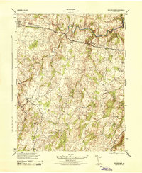
1944 Map of Rectortown
USGS Topo · Published 1944About this map
The boundary between Loudoun County and Fauquier County cuts through the northern landscape of this 1944 War Department survey, where the winding course of Goose Creek defines much of the local topography. The Southern railroad line serves as a central artery for the region, connecting the settlement of Rectortown to the broader Virginia transit network during the mid-war years. Small agricultural and industrial landmarks like the Milan Gristmill near Cromwells Run and a Race Track in the northeast indicate a mix of working land and local recreation. Genealogists will find notable burial sites such as Ivy Hill Cemetery, while several fords across Mill Run and other streams illustrate the rural road network of the 1940s. The presence of numerous U.S. Coast and Geodetic Survey markers, such as Upperville 1942 and Marshall 1942, anchors the map with precise historical survey data.
Find a feature on this map
20 named features on this map. Tap any name to fly to it.
Don’t see what you’re looking for? This feature index may not catch every label — zoom into the map to look around manually.
Map Details
Editions of this 1944 Rectortown Map
This is the sole edition of this map. No revisions or reprints were ever made.
Other maps of this area

1884 · Harpers Ferry
USGS Topo · 1:125,000

1891 · Harpers Ferry
USGS Topo · 1:125,000

1893 · Harpers Ferry
USGS Topo · 1:125,000

1894 · Warrenton
USGS Topo · 1:125,000

1916 · Berryville
USGS Topo · 1:62,500

1933 · Middleburg
USGS Topo · 1:62,500

1939 · Berryville
USGS Topo · 1:48,000

1943 · Bluemont
USGS Topo · 1:24,000

1943 · Thorofare Gap
USGS Topo · 1:24,000

1943 · Orlean
USGS Topo · 1:24,000