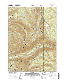
2014 Map of Red Blanket Mountain
USGS Topo · Published 2014About this map
The eastern boundary of Crater Lake National Park meets the Jackson and Klamath county line in this high-elevation mountain landscape. Dominated by the Rogue River National Forest, the terrain is defined by prominent volcanic features and steep drainage basins. Notable peaks like Red Blanket Mountain, Huckleberry Mtn, and Cinnamon Peak provide significant vertical relief above the surrounding valleys. A network of Forest Service roads, including Mill Creek Rd and Red Blanket Rd, provides access to the backcountry and historic natural landmarks. Waterways such as Red Blanket Cr and Dead Soldier Cr carve through the timbered slopes, while open areas like Dead Soldier Meadow offer a distinct contrast to the dense forest. This survey documents the intersection of protected wilderness and managed forest lands as they appeared in the early 21st century.
Find a feature on this map
37 named features on this map. Tap any name to fly to it.
Don’t see what you’re looking for? This feature index may not catch every label — zoom into the map to look around manually.
Map Details
Editions of this 2014 Red Blanket Mountain Map
This is the sole edition of this map. No revisions or reprints were ever made.
Other maps of this area

1891 · Ashland
USGS Topo · 1:250,000

1893 · Ashland
USGS Topo · 1:250,000

1897 · Ashland
USGS Topo · 1:250,000

1955 · Rustler Peak
USGS Topo · 1:62,500

1955 · Pelican Butte
USGS Topo · 1:62,500

1955 · Medford
USGS Topo · 1:250,000

1956 · Prospect
USGS Topo · 1:62,500

1957 · Medford
USGS Topo · 1:250,000

1958 · Medford
USGS Topo · 1:250,000
1975 · Prospect 1 NW
USGS Topo · 1:24,000