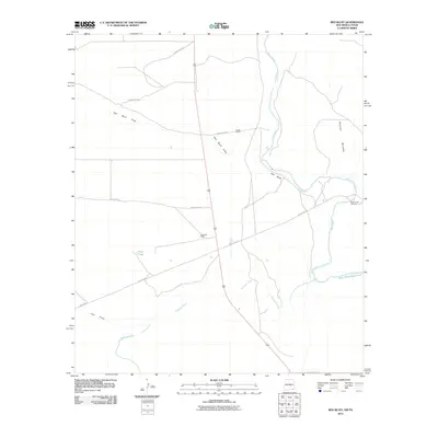
2010 Map of Red Bluff
USGS Topo · Published 2010About this map
Pecos River drainage patterns define this arid landscape along the New Mexico and Texas border, where the river winds southward toward the Red Bluff Reservoir. This 2010 survey illustrates the remote ranching and industrial infrastructure of Eddy County, anchored by established sites like the Queen Ranch and Delaware Ranch. The map captures a complex network of dry washes and canyons, including Red Bluff Draw, Owl Draw, and the prominent Rustler Breaks to the east. Transportation in this corner of the Permian Basin is primarily served by unpaved county routes and specialized infrastructure like Pipeline Rd, reflecting the region's long-standing connection to energy and land management. Significant water features such as the Delaware River, Mule Tank, and the historic Rock House Crossing provide critical landmarks in a terrain characterized by sparse settlement and wide-open rangeland.
Find a feature on this map
17 named features on this map. Tap any name to fly to it.
Don’t see what you’re looking for? This feature index may not catch every label — zoom into the map to look around manually.
Map Details
Editions of this 2010 Red Bluff Map
This is the sole edition of this map. No revisions or reprints were ever made.
Other maps of this area

1925 · Orla 2-b
USGS Topo · 1:48,000

1931 · Orla
USGS Topo · 1:62,500

1945 · Malaga
USGS Topo · 1:62,500

1946 · Malaga
USGS Topo · 1:62,500

1954 · Carlsbad
USGS Topo · 1:250,000

1954 · Hobbs
USGS Topo · 1:250,000

1954 · Van Horn
USGS Topo · 1:250,000

1954 · Pecos
USGS Topo · 1:250,000

1957 · Pecos
USGS Topo · 1:250,000

1958 · Van Horn
USGS Topo · 1:250,000