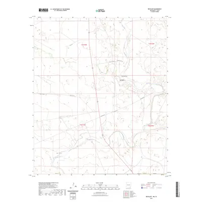
2023 Map of Red Bluff
USGS Topo · Published 2023About this map
The Pecos River snakes through the arid landscape of Eddy County, serving as the primary geographical marker for this section of southeastern New Mexico. Near the settlement of Red Bluff, the river is joined by the Red Bluff Draw, illustrating the complex drainage patterns of a region defined by seasonal water flow. To the south, the Delaware River cuts across the terrain, accompanied by smaller features like Owl Draw and Mule Tank, which were essential water sources for the cattle ranching operations that have long shaped the local economy. A sparse network of roads, including Cooksey Ranch Rd and Whitehorn Rd, connects isolated outposts and ranching properties across the township and range divisions. The map reveals the infrastructure of a remote borderlands environment, where geographic features like the rivers and draws provide the only orientation in an otherwise expansive and open landscape.
Find a feature on this map
18 named features on this map. Tap any name to fly to it.
Don’t see what you’re looking for? This feature index may not catch every label — zoom into the map to look around manually.
Map Details
Editions of this 2023 Red Bluff Map
This is the sole edition of this map. No revisions or reprints were ever made.
Other maps of this area

1925 · Orla 2-b
USGS Topo · 1:48,000

1931 · Orla
USGS Topo · 1:62,500

1945 · Malaga
USGS Topo · 1:62,500

1946 · Malaga
USGS Topo · 1:62,500

1954 · Carlsbad
USGS Topo · 1:250,000

1954 · Hobbs
USGS Topo · 1:250,000

1954 · Van Horn
USGS Topo · 1:250,000

1954 · Pecos
USGS Topo · 1:250,000

1957 · Pecos
USGS Topo · 1:250,000

1958 · Van Horn
USGS Topo · 1:250,000