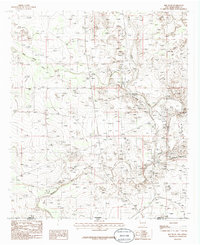
1985 Map of Red Bluff
USGS Topo · Published 1985About this map
The Pecos River snakes through this 1985 survey of the borderlands between New Mexico and Texas, a region defined by water management and transit. The map documents the engineering of the era, showcasing an Aqueduct, Siphon, and Flume alongside the Delaware River. These features illustrate how the arid landscape was adapted for agricultural or industrial use. To the east, the Rustler Hills and the Breaks create a textured backdrop to the river valley, while the northern tip of the Red Bluff Reservoir sits near the state line. Historic transit points like Rock House Crossing and localized landmarks such as East Apple Tank provide specific points of reference for those tracking the development of Eddy County. The presence of a Gravel Pit and a Radio Tower marks the sparse industrial footprint in this corner of the Chihuahuan Desert.
Find a feature on this map
18 named features on this map. Tap any name to fly to it.
Don’t see what you’re looking for? This feature index may not catch every label — zoom into the map to look around manually.
Map Details
Editions of this 1985 Red Bluff Map
This is the sole edition of this map. No revisions or reprints were ever made.
Other maps of this area

1925 · Orla 2-b
USGS Topo · 1:48,000

1931 · Orla
USGS Topo · 1:62,500

1945 · Malaga
USGS Topo · 1:62,500

1946 · Malaga
USGS Topo · 1:62,500

1954 · Carlsbad
USGS Topo · 1:250,000

1954 · Hobbs
USGS Topo · 1:250,000

1954 · Van Horn
USGS Topo · 1:250,000

1954 · Pecos
USGS Topo · 1:250,000

1957 · Pecos
USGS Topo · 1:250,000

1958 · Van Horn
USGS Topo · 1:250,000