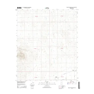
2014 Map of Red Bluff Mountain East
USGS Topo · Published 2014About this map
Red Bluff Mountain stands as a prominent landmark in this desert landscape within Yuma County, marking the western edge of the expansive Mohawk Valley. The terrain is defined by the natural drainage of Big Eye Wash, which cuts a broad path south through the central sections. Modern infrastructure and agricultural development appear in the southeastern corner, where Mohawk Canal Rd and E Avenue 3 1/2 E facilitate local transport near the valley floor. The map highlights the intersection of public land survey systems, including t7s r17w and t8s r18w, which organize the arid geography into precise grids. This survey captures the transition from the high relief of the mountain range to the low-lying valley flats where roads like E Paisano Dr begin to probe the desert edge.
Find a feature on this map
13 named features on this map. Tap any name to fly to it.
Don’t see what you’re looking for? This feature index may not catch every label — zoom into the map to look around manually.
Map Details
Editions of this 2014 Red Bluff Mountain East Map
This is the sole edition of this map. No revisions or reprints were ever made.
Other maps of this area

1926 · Wellton
USGS Topo · 1:62,500

1926 · Mohawk
USGS Topo · 1:62,500

1928 · Mohawk
USGS Topo · 1:62,500

1928 · Norton
USGS Topo · 1:62,500

1929 · Wellton
USGS Topo · 1:62,500

1929 · Norton
USGS Topo · 1:62,500

1942 · Yuma
USGS Topo · 1:250,000

1953 · Ajo
USGS Topo · 1:250,000

1954 · El Centro
USGS Topo · 1:250,000

1955 · El Centro
USGS Topo · 1:250,000