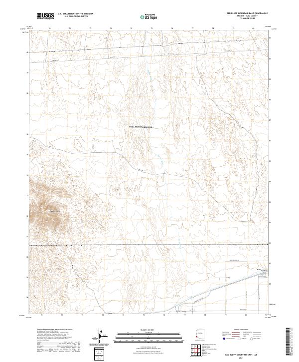
2021 Map of Red Bluff Mountain East
USGS Topo · Published 2021About this map
Red Bluff Mtn dominates the southwestern portion of this desert landscape, where steep contours rise sharply from the surrounding basins. The topography is defined by the broad expanse of the Mohawk Valley to the south and east, a region characterized by ephemeral drainage patterns including the prominent Big Eye Wash which meanders northward through the central townships. The map documents a sparse but critical network of desert transit, with Wellton Kofa Rd and Mohawk Canal Rd tracing the lower elevations. These routes reflect the historical and modern reliance on specific corridors for crossing the arid terrain of Yuma County. While the northern reaches of the quadrangle are largely undeveloped, the southern sections show more structured naming conventions with roads like Paisano Dr and E Co 5th St appearing near the valley floor.
Find a feature on this map
16 named features on this map. Tap any name to fly to it.
Don’t see what you’re looking for? This feature index may not catch every label — zoom into the map to look around manually.
Map Details
Editions of this 2021 Red Bluff Mountain East Map
This is the sole edition of this map. No revisions or reprints were ever made.
Other maps of this area

1926 · Wellton
USGS Topo · 1:62,500

1926 · Mohawk
USGS Topo · 1:62,500

1928 · Mohawk
USGS Topo · 1:62,500

1928 · Norton
USGS Topo · 1:62,500

1929 · Wellton
USGS Topo · 1:62,500

1929 · Norton
USGS Topo · 1:62,500

1942 · Yuma
USGS Topo · 1:250,000

1953 · Ajo
USGS Topo · 1:250,000

1954 · El Centro
USGS Topo · 1:250,000

1955 · El Centro
USGS Topo · 1:250,000