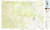
1979 Map of Red Bluff
USGS Topo · Published 1979About this map
Sacramento River drainage patterns define this late-1970s landscape, where the valley floor transitions into the Bald Hills and the slopes of the Trinity Mountains. The city of Red Bluff serves as a central hub, situated near the Red Bluff Diversion Dam and the Southern Pacific railroad corridor. The map details a period of established agricultural and water management infrastructure, including the Tehama Wildlife Management Area and various land grants like La Barranca Colorada. Small settlements and historic crossings such as Balls Ferry and Cottonwood dot the riverbanks, while the western reaches are dominated by the Yolla Bolly Middle Eel Wilderness and Mendocino National Forest. Resource extraction is noted at Kidds Knob Mine and Gray Mine, reflecting the diverse economic activities from ranching to mining that shaped Tehama and Shasta counties.
Find a feature on this map
76 named features on this map. Tap any name to fly to it.
Don’t see what you’re looking for? This feature index may not catch every label — zoom into the map to look around manually.
Map Details
Editions of this 1979 Red Bluff Map
3 editions found
Other maps of this area

1886 · Lassen Peak
USGS Topo · 1:250,000

1890 · Red Bluff
USGS Topo · 1:250,000

1891 · Chico
USGS Topo · 1:125,000

1892 · Lassen Peak
USGS Topo · 1:250,000

1893 · Chico
USGS Topo · 1:125,000

1894 · Lassen Peak
USGS Topo · 1:250,000

1894 · Red Bluff
USGS Topo · 1:250,000

1895 · Chico
USGS Topo · 1:125,000

1901 · Redding
USGS Topo · 1:125,000

1904 · Vina
USGS Topo · 1:62,500