Loading...
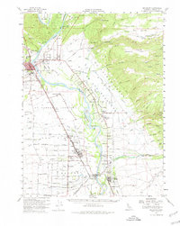
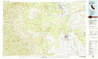
Loading map...1952 Map of Red Bluff
USGS Topo · Published 1980About this map
Red Bluff and the surrounding agricultural bottomlands of the northern Sacramento Valley are depicted during a period of significant mid-century development. The Sacramento River anchors the geography, winding past land grants like El Primero de los Berryessa and La Barranca Colorada, where orchard-lined roads and irrigation networks supported the local economy. The influence of the Southern Pacific railroad is evident in the alignment of towns like Gerber and Tehama, the latter featuring prominent drawbridges over the river.
Find a feature on this map
74 named features on this map. Tap any name to fly to it.
Don’t see what you’re looking for? This feature index may not catch every label — zoom into the map to look around manually.
Map Details
Date Portrayed1952
Date Published1980
PublisherU.S. Geological Survey
Map TypeTopographic
Scale1:62,500
Physical Dimensions17.3 x 21.7 inches
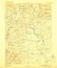
Editions of this 1952 Red Bluff Map
3 editions found
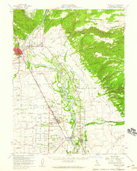
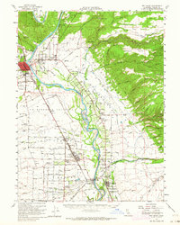
Historical Maps of Red Bluff Through Time
4 maps found

Featured Locations
Source Details
SourceU.S. Geological Survey
CopyrightPublic Domain