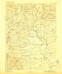
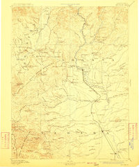
1894 Map of Red Bluff
USGS Topo · Published 1916About this map
Weaverville and the surrounding gold-country settlements anchor this late nineteenth-century survey of the rugged interior. The landscape is defined by the high peaks of the Bully Choop Mountains and Yolla Bolly Mountains, where narrow gulches and creeks like Sidney Gulch and Stuart Fork reflect the intense hydraulic and mineral activity of the era. The mapping of early post offices and stations, such as Stella P.O. and Buck Horn Station, highlights a network of remote outposts linked by trails and early toll roads before the proliferation of modern highways.
Find a feature on this map
188 named features on this map. Tap any name to fly to it.
Don’t see what you’re looking for? This feature index may not catch every label — zoom into the map to look around manually.
Map Details
Editions of this 1894 Red Bluff Map
6 editions found
Other maps of this area

1886 · Lassen Peak
USGS Topo · 1:250,000

1886 · Modoc Lava Bed
USGS Topo · 1:250,000

1886 · Shasta
USGS Topo · 1:250,000

1890 · Red Bluff
USGS Topo · 1:250,000

1891 · Chico
USGS Topo · 1:125,000

1892 · Modoc Lava-Bed
USGS Topo · 1:250,000

1892 · Lassen Peak
USGS Topo · 1:250,000

1893 · Chico
USGS Topo · 1:125,000

1894 · Lassen Peak
USGS Topo · 1:250,000

1894 · Red Bluff
USGS Topo · 1:250,000