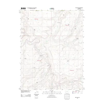
2013 Map of Red Canyon
USGS Topo · Published 2013About this map
Dolores River and San Miguel River dominate this West Slope landscape, carving deep relief through the high mesas of western Colorado. The terrain is defined by dramatic elevation shifts, where isolated landforms like Blue Mesa, Lone Tree Mesa, and Atkinson Mesa stand above a network of canyons and drainage systems. This 2013 survey illustrates how transportation follows the contours of the water, with Co-141 snaking along the riverbed through Red Canyon and past the distinctive Beehive Canyon. Away from the river corridors, the map documents a series of rural routes such as s12 RD and q12 RD that provide access to the expansive Carpenter Flats and the high plateaus. The topography reveals the natural barriers that have long dictated movement and land use in this part of the Colorado Plateau.
Find a feature on this map
37 named features on this map. Tap any name to fly to it.
Don’t see what you’re looking for? This feature index may not catch every label — zoom into the map to look around manually.
Map Details
Editions of this 2013 Red Canyon Map
This is the sole edition of this map. No revisions or reprints were ever made.
Other maps of this area

1916 · Paradox Valley
USGS Topo · 1:125,000

1922 · Paradox Valley
USGS Topo · 1:125,000

1948 · Roc Creek
USGS Topo · 1:24,000

1948 · Uravan
USGS Topo · 1:24,000

1948 · Paradox
USGS Topo · 1:24,000

1949 · Davis Mesa
USGS Topo · 1:24,000

1949 · Uravan
USGS Topo · 1:24,000

1949 · Paradox
USGS Topo · 1:24,000

1949 · Roc Creek
USGS Topo · 1:24,000

1949 · Juanita Arch
USGS Topo · 1:24,000