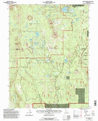
1995 Map of Red Cinder
USGS Topo · Published 1998About this map
The Caribou Wilderness and Lassen National Forest dominate this high-country landscape, marked by volcanic features and a dense network of alpine lakes. Named summits like Red Cinder and Black Cinder Rock rise above the timberline, while the northeastern corner reveals the reach of Eagle Lake Almanor near Silver Lake. The map details a landscape transitioning from the protected Lassen Volcanic National Park in the northwest to the managed timberlands of the Swain Mountain Experimental Forest in the east.
Find a feature on this map
57 named features on this map. Tap any name to fly to it.
Don’t see what you’re looking for? This feature index may not catch every label — zoom into the map to look around manually.
Map Details
Editions of this 1995 Red Cinder Map
This is the sole edition of this map. No revisions or reprints were ever made.
Other maps of this area

1886 · Lassen Peak
USGS Topo · 1:250,000

1892 · Lassen Peak
USGS Topo · 1:250,000

1894 · Lassen Peak
USGS Topo · 1:250,000

1939 · Halls Flat
USGS Topo · 1:125,000

1955 · Westwood
USGS Topo · 1:250,000

1956 · Mt. Harkness
USGS Topo · 1:62,500

1956 · Chester
USGS Topo · 1:62,500

1956 · Harvey Mtn
USGS Topo · 1:62,500

1957 · Prospect Peak
USGS Topo · 1:62,500

1958 · Westwood
USGS Topo · 1:250,000