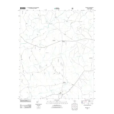
2011 Map of Red Hill
USGS Topo · Published 2011About this map
Johnson Crossroads and West Store Crossroads anchor the southern landscape of this 2011 survey, illustrating the persistent importance of road junctions in rural Edgefield County. The map details a web of local routes including Guy Williams Rd and Barr Chapel Rd, connecting small communities like Cleora and Antioch across a terrain defined by the drainage of Turkey Creek and Beaverdam Creek. Genealogy remains a central focus of this sheet, which preserves the locations of numerous family-named burial grounds such as Hollingsworth-Walker Cemetery, Cochran Cemetery, and the Corley Cemetery. Further inland, the map identifies practical landmarks like Morgan Bridge and Gilgal Bridge, alongside water management features such as Mathis Pond Dam. The intersection of nature and infrastructure is clear as small tributaries like Gundy Creek and Camp Branch wind through the fragmented agricultural and forested plots of this South Carolina region.
Find a feature on this map
52 named features on this map. Tap any name to fly to it.
Don’t see what you’re looking for? This feature index may not catch every label — zoom into the map to look around manually.
Map Details
Editions of this 2011 Red Hill Map
This is the sole edition of this map. No revisions or reprints were ever made.
Other maps of this area

1892 · Mc Cormick
USGS Topo · 1:125,000

1912 · Mc Cormick
USGS Topo · 1:125,000

1920 · Clarks Hill
USGS Topo · 1:48,000

1921 · Clarks Hill
USGS Topo · 1:62,500

1923 · Warrenville
USGS Topo · 1:48,000

1928 · Warrenville
USGS Topo · 1:62,500

1941 · Clarks Hill
USGS Topo · 1:62,500

1942 · Clarks Hill
USGS Topo · 1:62,500

1943 · Warrenville
USGS Topo · 1:62,500

1953 · Athens
USGS Topo · 1:250,000