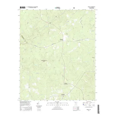
2017 Map of Red Hill
USGS Topo · Published 2017About this map
Sumter National Forest defines the central character of this portion of Edgefield and McCormick Counties, where the landscape is etched by a dense network of tributaries. Significant waterways such as Turkey Creek, Beaverdam Cr, and Little Beaverdam Cr flow through the wooded terrain, bridged by landmarks like Gilgal Bridge and Morgan Bridge. The settlement pattern is dominated by historic road junctions, with Brunson Crossroads, Johnson Crossroads, and West Store Crossroads serving as the primary local hubs.
Find a feature on this map
48 named features on this map. Tap any name to fly to it.
Don’t see what you’re looking for? This feature index may not catch every label — zoom into the map to look around manually.
Map Details
Editions of this 2017 Red Hill Map
This is the sole edition of this map. No revisions or reprints were ever made.
Other maps of this area

1892 · Mc Cormick
USGS Topo · 1:125,000

1912 · Mc Cormick
USGS Topo · 1:125,000

1920 · Clarks Hill
USGS Topo · 1:48,000

1921 · Clarks Hill
USGS Topo · 1:62,500

1923 · Warrenville
USGS Topo · 1:48,000

1928 · Warrenville
USGS Topo · 1:62,500

1941 · Clarks Hill
USGS Topo · 1:62,500

1942 · Clarks Hill
USGS Topo · 1:62,500

1943 · Warrenville
USGS Topo · 1:62,500

1953 · Athens
USGS Topo · 1:250,000