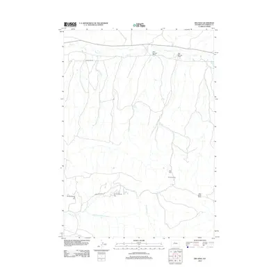
2012 Map of Red Hole
USGS Topo · Published 2012About this map
The oil-producing landscape of Hot Springs County is clearly defined here through several active extraction areas. The Red Hole Oil Field occupies the central territory, while the southern reaches are marked by the West Warm Springs Oil Field and East Warm Springs Oil Field. These sites illustrate the localized industrial footprint in this part of Wyoming, where infrastructure follows the natural drainages and breaks in the terrain.
Find a feature on this map
14 named features on this map. Tap any name to fly to it.
Don’t see what you’re looking for? This feature index may not catch every label — zoom into the map to look around manually.
Map Details
Editions of this 2012 Red Hole Map
This is the sole edition of this map. No revisions or reprints were ever made.
Other maps of this area

1945 · Kirby
USGS Topo · 1:62,500

1946 · Kirby
USGS Topo · 1:62,500

1955 · Thermopolis
USGS Topo · 1:250,000

1955 · Arminto
USGS Topo · 1:250,000

1958 · Thermopolis
USGS Topo · 1:250,000

1958 · Arminto
USGS Topo · 1:250,000

1960 · Devil Slide
USGS Topo · 1:24,000

1960 · Coyote Hill
USGS Topo · 1:24,000
1960 · Blue Hill
USGS Topo · 1:24,000

1960 · Red Hole
USGS Topo · 1:24,000