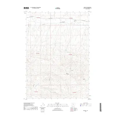
2017 Map of Red Hole
USGS Topo · Published 2017About this map
Red Hole and the surrounding high desert of Hot Springs County are defined by a network of seasonal drainages and topographic landmarks in this modern survey. The terrain is deeply incised by Black Willow Draw and several branches of Warm Springs Cr, including the Middle Fork Warm Springs Cr, which flow toward the south. To the north, the landscape is shaped by the Kirby Cr watershed, including Rock Springs Draw and Red Springs Draw. Human presence is marked primarily by the established routes of Black Mountain Rd and S Kirby Creek Rd, which provide access through this arid environment. Significant natural features like Wild Horse Butte and Rock Springs serve as essential reference points for navigation and land management within the complex drainage patterns of the region.
Find a feature on this map
17 named features on this map. Tap any name to fly to it.
Don’t see what you’re looking for? This feature index may not catch every label — zoom into the map to look around manually.
Map Details
Editions of this 2017 Red Hole Map
This is the sole edition of this map. No revisions or reprints were ever made.
Other maps of this area

1945 · Kirby
USGS Topo · 1:62,500

1946 · Kirby
USGS Topo · 1:62,500

1955 · Thermopolis
USGS Topo · 1:250,000

1955 · Arminto
USGS Topo · 1:250,000

1958 · Thermopolis
USGS Topo · 1:250,000

1958 · Arminto
USGS Topo · 1:250,000

1960 · Devil Slide
USGS Topo · 1:24,000

1960 · Coyote Hill
USGS Topo · 1:24,000
1960 · Blue Hill
USGS Topo · 1:24,000

1960 · Red Hole
USGS Topo · 1:24,000