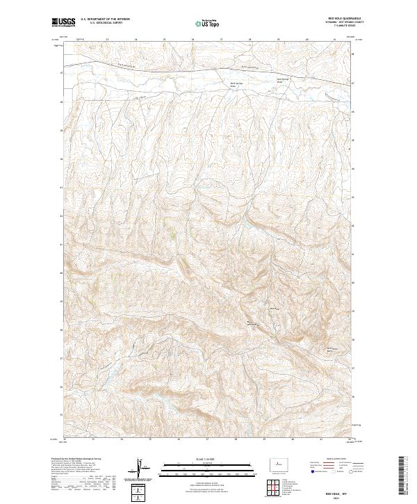
2021 Map of Red Hole
USGS Topo · Published 2021About this map
The high desert landscape of t43n r93w is defined by the intricate drainage systems and topographic depressions that characterize this portion of Hot Springs County. The namesake Red Hole basin and the prominent Wild Horse Butte stand as central landmarks amidst a network of seasonal watercourses. These ephemeral channels, including Rock Springs Draw and Red Springs Draw, reveal the erosional patterns of the terrain, while Black Willow Draw cuts through the central section of the quadrangle.
Find a feature on this map
19 named features on this map. Tap any name to fly to it.
Don’t see what you’re looking for? This feature index may not catch every label — zoom into the map to look around manually.
Map Details
Editions of this 2021 Red Hole Map
This is the sole edition of this map. No revisions or reprints were ever made.
Other maps of this area

1945 · Kirby
USGS Topo · 1:62,500

1946 · Kirby
USGS Topo · 1:62,500

1955 · Thermopolis
USGS Topo · 1:250,000

1955 · Arminto
USGS Topo · 1:250,000

1958 · Thermopolis
USGS Topo · 1:250,000

1958 · Arminto
USGS Topo · 1:250,000

1960 · Devil Slide
USGS Topo · 1:24,000

1960 · Coyote Hill
USGS Topo · 1:24,000
1960 · Blue Hill
USGS Topo · 1:24,000

1960 · Red Hole
USGS Topo · 1:24,000