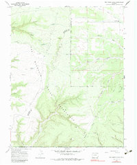
1966 Map of Red Horse Gulch
USGS Topo · Published 1983About this map
The Southern Ute Indian Reservation dominates this 1960s landscape, where the high desert terrain of the Colorado-New Mexico border is marked by a high density of archaeological sites. Numerous Indian Ruins and Cliff Dwellings are identified along the canyon walls, particularly surrounding Johnson Canyon and Mancos Spring. This map reflects a period of modern resource development overlaid upon ancient foundations, evidenced by the presence of a Gas Well and several Drill Hole sites scattered among the mesas. Water management is a central theme in this arid environment, shown through features like Floyd Reservoir, Peterson Reservoir, and First Reservoir. The presence of the Mountain View Sch near the northern boundary provides a rare point of community infrastructure in a territory otherwise defined by winding drainages like Red Horse Gulch and Barker Arroyo.
Find a feature on this map
26 named features on this map. Tap any name to fly to it.
Don’t see what you’re looking for? This feature index may not catch every label — zoom into the map to look around manually.
Map Details
Editions of this 1966 Red Horse Gulch Map
2 editions found
Other maps of this area

1889 · Chaco
USGS Topo · 1:250,000

1892 · Chaco
USGS Topo · 1:250,000

1912 · Soda Canyon
USGS Topo · 1:62,500

1913 · Red Mesa
USGS Topo · 1:62,500

1915 · Soda Canyon
USGS Topo · 1:62,500

1954 · Shiprock
USGS Topo · 1:250,000

1956 · Cortez
USGS Topo · 1:250,000

1958 · Cortez
USGS Topo · 1:250,000

1958 · Shiprock
USGS Topo · 1:250,000

1959 · Shiprock
USGS Topo · 1:250,000