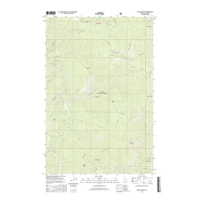
2017 Map of Red Ives Peak
USGS Topo · Published 2017About this map
The Saint Joe River winds through the high-elevation terrain of St. Joe National Forest, a landscape defined by sharp ridges and deep creek drainages in northern Idaho. This 2017 survey details the complex topography of the Bitterroot Mountains, where prominent summits like Simmons Peak, Red Ives Peak, and Needle Peak dominate the skyline. The map reveals a network of Forest Service infrastructure, including St Joe River Rd and specialized routes such as Nat For Dev Rd 320. Significant recreational and navigational landmarks are noted, from the waters of Swimming Bear Lake to established paths like the Broken Leg Trail and Elbow Ridge NRT. The area is carved by numerous tributaries, including Wahoo Cr, Indian Cr, and Red Ives Cr, reflecting a wilderness preserved for timber and watershed management.
Find a feature on this map
58 named features on this map. Tap any name to fly to it.
Don’t see what you’re looking for? This feature index may not catch every label — zoom into the map to look around manually.
Map Details
Editions of this 2017 Red Ives Peak Map
This is the sole edition of this map. No revisions or reprints were ever made.
Other maps of this area

1911 · Lolo
USGS Topo · 1:250,000

1913 · Lolo
USGS Topo · 1:250,000

1918 · St Regis
USGS Topo · 1:125,000

1919 · St. Regis
USGS Topo · 1:125,000

1956 · Wallace
USGS Topo · 1:250,000

1956 · Hamilton
USGS Topo · 1:250,000

1957 · Illinois Peak
USGS Topo · 1:62,500

1957 · Simmons Peak
USGS Topo · 1:62,500

1959 · Hamilton
USGS Topo · 1:250,000

1960 · Wallace
USGS Topo · 1:250,000