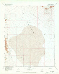
1968 Map of Red Lake
USGS Topo · Published 1972About this map
Red Lake dominates this arid landscape within the broader Hualapai Valley (Depression), where the flat basin floor meets the rising slopes of the Cerbat Mountains. Photogrammetric methods from 1967 reveal a terrain shaped by water management in a desert environment, evidenced by a network of isolated water sources such as Valley Tank, Lake Tank, and Well Tank. This era of the valley is defined by sparse infrastructure, with Stockton Hill Road providing the primary north-south transit route while various unnamed roads and a Jeep Trail branch into the mountain foothills. The presence of specialized ranching or livestock infrastructure, including Corner Tank and North Tank, highlights the land use patterns typical of Mohave County before modern expansion altered these remote reaches.
Find a feature on this map
14 named features on this map. Tap any name to fly to it.
Don’t see what you’re looking for? This feature index may not catch every label — zoom into the map to look around manually.
Map Details
Editions of this 1968 Red Lake Map
2 editions found
Other maps of this area

1886 · Diamond Creek
USGS Topo · 1:250,000

1886 · Camp Mohave
USGS Topo · 1:250,000

1892 · Diamond Creek
USGS Topo · 1:250,000

1892 · Camp Mohave
USGS Topo · 1:250,000

1942 · Camp Mohave
USGS Topo · 1:250,000

1947 · Kingman
USGS Topo · 1:250,000

1948 · Kingman
USGS Topo · 1:250,000

1948 · Williams
USGS Topo · 1:250,000

1954 · Kingman
USGS Topo · 1:250,000

1954 · Williams
USGS Topo · 1:250,000