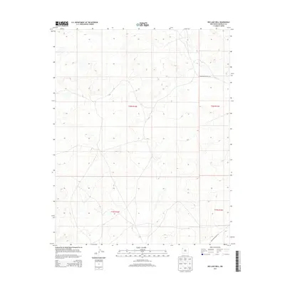
2013 Map of Red Lake Well
USGS Topo · Published 2013About this map
Indian Cr winds through this arid section of the Fort Defiance Agency region, providing the primary natural drainage for a landscape defined by its high-desert topography. The area is intersected by early 21st-century infrastructure, including Indian Service Route 7141 in the northern half and Indian Service Route 7101 crossing the southern boundary. These routes represent the primary terrestrial connectivity for the Bureau of Indian Affairs and local residents. The map's grid is strictly defined by township and range boundaries, specifically where t20n r14w, t20n r13w, t19n r14w, and t19n r13w converge. This survey provides a baseline of the regional hydrology and transportation network in McKinley County prior to more recent developments.
Find a feature on this map
7 named features on this map. Tap any name to fly to it.
Don’t see what you’re looking for? This feature index may not catch every label — zoom into the map to look around manually.
Map Details
Editions of this 2013 Red Lake Well Map
This is the sole edition of this map. No revisions or reprints were ever made.
Other maps of this area

1886 · Wingate
USGS Topo · 1:250,000

1889 · Chaco
USGS Topo · 1:250,000

1892 · Wingate
USGS Topo · 1:250,000

1892 · Chaco
USGS Topo · 1:250,000

1954 · Shiprock
USGS Topo · 1:250,000

1954 · Gallup
USGS Topo · 1:250,000

1958 · Gallup
USGS Topo · 1:250,000

1958 · Shiprock
USGS Topo · 1:250,000

1959 · Shiprock
USGS Topo · 1:250,000

1959 · Gallup
USGS Topo · 1:250,000