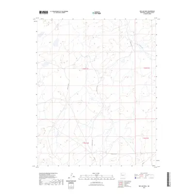
2023 Map of Red Lake Well
USGS Topo · Published 2023About this map
Indian Creek meanders through the arid drainage basins of McKinley County, defining the hydrologic character of this high-desert landscape. The area is defined by its tribal infrastructure, primarily the network of service roads that facilitate movement across the plateau. Modern transit is represented by Indian Svc Rte 7057 and Indian Svc Rte 7101, which follow the contours of the terrain rather than a strict grid. These routes, including segments labeled as Ind Sr 7057 and R R 7101, highlight the essential connectivity required in these expansive open spaces. Surveyed within the boundaries of Township 20 North and Township 19 North, the map provides a look at the interplay between natural drainages and the road networks developed to navigate them.
Find a feature on this map
10 named features on this map. Tap any name to fly to it.
Don’t see what you’re looking for? This feature index may not catch every label — zoom into the map to look around manually.
Map Details
Editions of this 2023 Red Lake Well Map
This is the sole edition of this map. No revisions or reprints were ever made.
Other maps of this area

1886 · Wingate
USGS Topo · 1:250,000

1889 · Chaco
USGS Topo · 1:250,000

1892 · Wingate
USGS Topo · 1:250,000

1892 · Chaco
USGS Topo · 1:250,000

1954 · Shiprock
USGS Topo · 1:250,000

1954 · Gallup
USGS Topo · 1:250,000

1958 · Gallup
USGS Topo · 1:250,000

1958 · Shiprock
USGS Topo · 1:250,000

1959 · Shiprock
USGS Topo · 1:250,000

1959 · Gallup
USGS Topo · 1:250,000