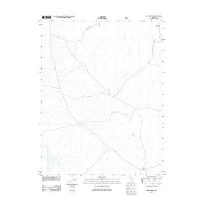
2012 Map of Red Ledges
USGS Topo · Published 2012About this map
Cow Camp serves as a lone human marker in this drainage-dominated landscape of White Pine County, where water movement has carved the high desert terrain. The eponymous Red Ledges rise in the southeast, providing a geological anchor to a region defined by seasonal watercourses like Murphy Wash and Johns Wash. These intermittent streams dictate the orientation of the local infrastructure, with routes such as Johns Wash Rd and the Natl Forest Develop Road 451 Rd following the natural contours of the land. In the northeast, the terrain deepens into West Fork Canyon, while The Troughs in the south indicate specific points of water management or livestock use. The network of county and forest roads, including Co Rd-1116, provides a clear view of how this area is accessed for ranching and resource management.
Find a feature on this map
12 named features on this map. Tap any name to fly to it.
Don’t see what you’re looking for? This feature index may not catch every label — zoom into the map to look around manually.
Map Details
Editions of this 2012 Red Ledges Map
This is the sole edition of this map. No revisions or reprints were ever made.
Other maps of this area

1948 · Wheeler Peak
USGS Topo · 1:62,500

1949 · Garrison
USGS Topo · 1:62,500

1950 · Wheeler Peak
USGS Topo · 1:62,500

1951 · Garrison
USGS Topo · 1:62,500

1956 · Lund
USGS Topo · 1:250,000

1960 · Lund
USGS Topo · 1:250,000

1972 · Hyde Well
USGS Topo · 1:24,000

1972 · Big Springs
USGS Topo · 1:24,000

1973 · Indian Springs Knolls
USGS Topo · 1:24,000

1973 · Red Ledges
USGS Topo · 1:24,000