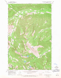
1966 Map of Red Meadow Lake
USGS Topo · Published 1971About this map
Flathead National Forest land defines this section of the Whitefish Range, where the boundary between Flathead Co and Lincoln Co traverses high ridgelines and prominent summits. In the mid-1960s, this area was accessible primarily by a network of trails, pack trails, and a rugged jeep trail that navigated the drainages of Whale Creek and Ninko Creek. The landscape is dotted with high-elevation water bodies, including the Chain Lakes, Link Lake, and Red Meadow Lake, the latter of which features the Red Meadow Campground. Notable peaks like Nasukoin Mtn and Akinkoka Peak dominate the topography, providing a detailed look at the drainage patterns for Moose Creek and Red Meadow Creek before they descend into the lower valleys. This survey captures the primitive recreational infrastructure of the era, from the falls at Whale Creek Falls to the various unnamed peaks that characterize this part of Northwest Montana.
Find a feature on this map
25 named features on this map. Tap any name to fly to it.
Don’t see what you’re looking for? This feature index may not catch every label — zoom into the map to look around manually.
Map Details
Editions of this 1966 Red Meadow Lake Map
2 editions found
Other maps of this area

1906 · Kintla Lakes
USGS Topo · 1:125,000

1913 · Stryker
USGS Topo · 1:125,000

1916 · Stryker
USGS Topo · 1:125,000

1938 · Kintla Lakes
USGS Topo · 1:125,000

1957 · Kalispell
USGS Topo · 1:250,000

1960 · Kalispell
USGS Topo · 1:250,000

1961 · Kalispell
USGS Topo · 1:250,000

1966 · Red Meadow Lake
USGS Topo · 1:24,000
1966 · Bull Lake
USGS Topo · 1:24,000

1966 · Mount Hefty
USGS Topo · 1:24,000