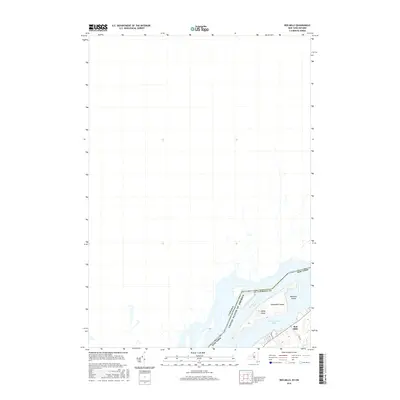
2016 Map of Red Mills
USGS Topo · Published 2016About this map
The Saint Lawrence River serves as the dominant geographic feature and international boundary in this northern borderland, where New York and Canada meet. The river's complex channel is defined by several prominent landforms, including Galop Island, Shoemaker Island, and Benedict Island, which navigate the waters near the international line.
Find a feature on this map
10 named features on this map. Tap any name to fly to it.
Don’t see what you’re looking for? This feature index may not catch every label — zoom into the map to look around manually.
Map Details
Editions of this 2016 Red Mills Map
This is the sole edition of this map. No revisions or reprints were ever made.
Other maps of this area

1904 · Lisbon
USGS Topo · 1:48,000

1904 · Ogdensburg
USGS Topo · 1:62,500

1905 · Ogdensburg
USGS Topo · 1:62,500

1906 · Brier Hill
USGS Topo · 1:62,500

1906 · Red Mills
USGS Topo · 1:62,500

1943 · Ogdensburg East
USGS Topo · 1:31,680

1943 · Lisbon
USGS Topo · 1:31,680
1943 · Red Mills
USGS Topo · 1:31,680
1943 · Sparrowhawk Point
USGS Topo · 1:31,680
1943 · Ogdensburg West
USGS Topo · 1:31,680