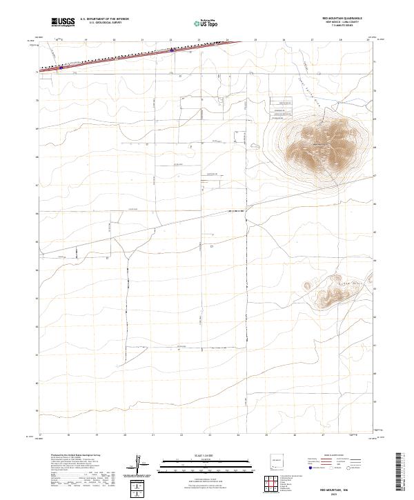
2023 Map of Red Mountain
USGS Topo · Published 2023About this map
Red Mountain dominates the northeast corner of this arid landscape, rising above a network of desert roads and township boundaries in Luna County. The terrain is defined by the stark prominence of the peak and the smaller Snake Hills to the southeast, while the ephemeral Jones Spring Draw cuts through the northern flats. This modern survey illustrates the expansive grid system of the American West, where names like Pearlonion Rd, Chives Rd, and Sombrero Rd mark the routes connecting remote parcels. The map provides a precise look at the Public Land Survey System divisions, including t24s r10w and t24s r11w, alongside the I-10 Frontage Rd corridor that skirts the northern edge of the quadrangle.
Find a feature on this map
24 named features on this map. Tap any name to fly to it.
Don’t see what you’re looking for? This feature index may not catch every label — zoom into the map to look around manually.
Map Details
Editions of this 2023 Red Mountain Map
This is the sole edition of this map. No revisions or reprints were ever made.
Other maps of this area

1899 · Deming
USGS Topo · 1:125,000

1915 · Deming
USGS Topo · 1:125,000

1954 · Silver City
USGS Topo · 1:250,000

1955 · Las Cruces
USGS Topo · 1:250,000

1958 · Las Cruces
USGS Topo · 1:250,000

1958 · Silver City
USGS Topo · 1:250,000

1962 · Silver City
USGS Topo · 1:250,000

1963 · Gage
USGS Topo · 1:24,000
1963 · Gage SE
USGS Topo · 1:24,000
1964 · Grandmother Mountain East
USGS Topo · 1:24,000