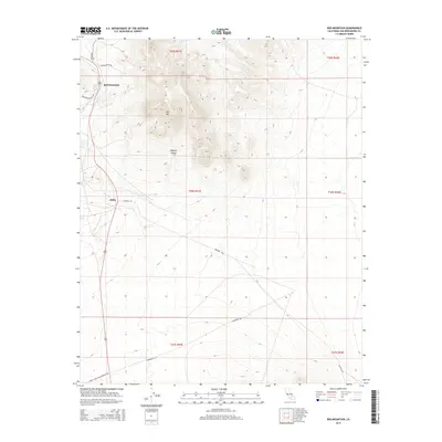
2015 Map of Red Mountain
USGS Topo · Published 2015About this map
Red Mountain and the neighboring settlement of Atolia anchor this desert landscape, situated at the edge of the high western Mojave Desert. The topography is dominated by the prominent peak of Red Mtn, which rises above a network of historical transit routes and mining-era infrastructure. A rare water source, Squaw Spring, is located to the north, suggesting the critical role of reliable water in this arid environment.
Find a feature on this map
17 named features on this map. Tap any name to fly to it.
Don’t see what you’re looking for? This feature index may not catch every label — zoom into the map to look around manually.
Map Details
Editions of this 2015 Red Mountain Map
This is the sole edition of this map. No revisions or reprints were ever made.
Other maps of this area

1903 · Randsburg
USGS Topo · 1:62,500

1911 · Randsburg
USGS Topo · 1:62,500

1912 · Randsburg
USGS Topo · 1:62,500

1915 · Searles Lake
USGS Topo · 1:250,000

1947 · Trona
USGS Topo · 1:250,000

1948 · Trona
USGS Topo · 1:250,000

1953 · Trona
USGS Topo · 1:250,000
1954 · Boron
USGS Topo · 1:62,500

1954 · Cuddeback Lake
USGS Topo · 1:62,500

1956 · Fremont Peak
USGS Topo · 1:62,500