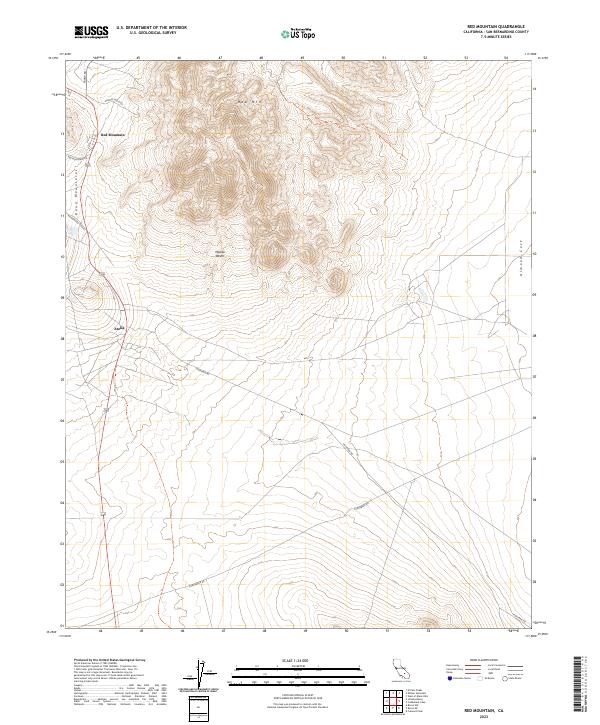
2023 Map of Red Mountain
USGS Topo · Published 2023About this map
Red Mountain and the nearby settlement of Atolia anchor this portion of the western Mojave Desert, where the landscape is defined by the steep elevation of the Rand Mountains. The prominent peak of Red Mtn rises above a network of desert roads, including the Randsburg Cutoff and Trona Rd, which connect these mining-era locales. The eastern portion of the sheet transitions into the protected landscape of the Golden Valley Wilderness, showing the contrast between concentrated human activity along the mountain slopes and the undisturbed desert terrain of Almond Cove. This map provides a look at the enduring road networks that served the historic tungsten and gold districts, tracing routes like Cuddeback Rd and Hoffman Rd through the arid basin.
Find a feature on this map
19 named features on this map. Tap any name to fly to it.
Don’t see what you’re looking for? This feature index may not catch every label — zoom into the map to look around manually.
Map Details
Editions of this 2023 Red Mountain Map
This is the sole edition of this map. No revisions or reprints were ever made.
Other maps of this area

1903 · Randsburg
USGS Topo · 1:62,500

1911 · Randsburg
USGS Topo · 1:62,500

1912 · Randsburg
USGS Topo · 1:62,500

1915 · Searles Lake
USGS Topo · 1:250,000

1947 · Trona
USGS Topo · 1:250,000

1948 · Trona
USGS Topo · 1:250,000

1953 · Trona
USGS Topo · 1:250,000
1954 · Boron
USGS Topo · 1:62,500

1954 · Cuddeback Lake
USGS Topo · 1:62,500

1956 · Fremont Peak
USGS Topo · 1:62,500