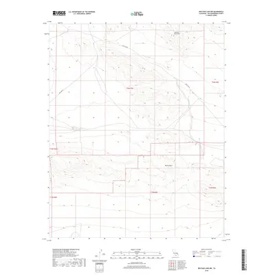
2018 Map of Red Pass Lake NW
USGS Topo · Published 2018About this map
Avawatz Mountains dominate the northern landscape of this region, their complex contours descending into the expansive Mojave Desert below. This desert terrain is sparsely populated, defined primarily by its geographic isolation and the long stretches of transportation routes that navigate the arid floor. Historical surveying boundaries, including t16n r5e and t15n r5e, segment the territory into its legal townships, reflecting the systematic grid-based organization of public lands in the West. Silver Lake Rd and Fort Irwin Rd provide the only significant access points through this environment, tracing paths that have served travelers and military personnel in San Bernardino County for decades.
Find a feature on this map
10 named features on this map. Tap any name to fly to it.
Don’t see what you’re looking for? This feature index may not catch every label — zoom into the map to look around manually.
Map Details
Editions of this 2018 Red Pass Lake NW Map
This is the sole edition of this map. No revisions or reprints were ever made.
Other maps of this area

1933 · Avawatz Mountains
USGS Topo · 1:250,000

1947 · Trona
USGS Topo · 1:250,000

1948 · Red Pass Lake
USGS Topo · 1:62,500

1948 · Trona
USGS Topo · 1:250,000

1948 · Leach Lake
USGS Topo · 1:62,500

1948 · Avawatz Pass
USGS Topo · 1:62,500

1948 · Tiefort Mountains
USGS Topo · 1:62,500

1951 · Tiefort Mountains
USGS Topo · 1:62,500

1951 · Avawatz Pass
USGS Topo · 1:62,500

1951 · Red Pass Lake
USGS Topo · 1:62,500