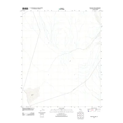
2012 Map of Red Pass Lake
USGS Topo · Published 2012About this map
Red Pass Lake defines the southwestern corner of this San Bernardino County landscape, appearing as a dry lake bed or playa characteristic of the Mojave Desert. The terrain is marked by a complex network of ephemeral washes and drainage patterns that flow from the surrounding elevations toward the lower basins. Infrastructure in this sparsely populated region is limited, dominated primarily by the diagonal path of Powerline Rd, which cuts across the southern portion of the quadrangle. This 2012 survey illustrates the stark, utilitarian nature of the desert interior, where human presence is defined more by industrial corridors and topographical markers than by permanent settlements.
Find a feature on this map
2 named features on this map. Tap any name to fly to it.
Don’t see what you’re looking for? This feature index may not catch every label — zoom into the map to look around manually.
Map Details
Editions of this 2012 Red Pass Lake Map
This is the sole edition of this map. No revisions or reprints were ever made.
Other maps of this area

1933 · Avawatz Mountains
USGS Topo · 1:250,000

1947 · Trona
USGS Topo · 1:250,000

1948 · Red Pass Lake
USGS Topo · 1:62,500

1948 · Trona
USGS Topo · 1:250,000

1948 · Cave Mountain
USGS Topo · 1:62,500

1951 · Cave Mountain
USGS Topo · 1:62,500

1951 · Red Pass Lake
USGS Topo · 1:62,500

1953 · Trona
USGS Topo · 1:250,000
1956 · Soda Lake
USGS Topo · 1:62,500

1956 · Baker
USGS Topo · 1:62,500