
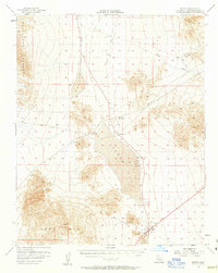
1956 Map of Baker
USGS Topo · Published 1957About this map
The Silver Lake basin serves as the central hub for this mid-century desert survey, where industrial and transport history meet the arid floor of the Mojave. Baker appears in its development as a critical desert junction, complete with an Oil Tank, Cemetery, and a Landing Strip. The landscape is defined by the remnants of earlier extraction and transit, notably the Old Railroad Grade that cuts through the valley and the Silver Lake Mine located high in the Silurian Hills. Mining activity is further evidenced by the Aga Mine and various prospects labeled simply as Talc or Tunnel. To the south, the expansive Soda Lake sits at the base of the Soda Mts, while the northern reaches are drained by Salt Creek and the Riggs Wash. The map records a transition from traditional rail-based mining to modern aviation, signaled by the Silver Lake Airport and several remote Substation and Water Tank sites.
Find a feature on this map
28 named features on this map. Tap any name to fly to it.
Don’t see what you’re looking for? This feature index may not catch every label — zoom into the map to look around manually.
Map Details
Editions of this 1956 Baker Map
3 editions found
Other maps of this area

1910 · Ivanpah
USGS Topo · 1:250,000

1912 · Ivanpah
USGS Topo · 1:250,000

1933 · Avawatz Mountains
USGS Topo · 1:250,000

1942 · Ivanpah
USGS Topo · 1:250,000

1947 · Trona
USGS Topo · 1:250,000

1947 · Kingman
USGS Topo · 1:250,000

1948 · Kingman
USGS Topo · 1:250,000

1948 · Red Pass Lake
USGS Topo · 1:62,500

1948 · Trona
USGS Topo · 1:250,000

1948 · Cave Mountain
USGS Topo · 1:62,500