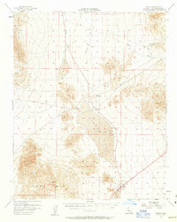
1956 Map of Baker
USGS Topo · Published 1963About this map
The arid expanse of the Mojave Desert defines this mid-century landscape, where the settlement of Baker serves as a critical junction near the southern edge of the sheet. The map documents an area deeply tied to mineral extraction and early transport, centered on the expansive dry basins of Silver Lake and Soda Lake. The Old Railroad Grade traces a linear path through the valley floor, connecting defunct stops like Riggs and Talc to the larger regional network.
Find a feature on this map
26 named features on this map. Tap any name to fly to it.
Don’t see what you’re looking for? This feature index may not catch every label — zoom into the map to look around manually.
Map Details
Editions of this 1956 Baker Map
3 editions found

Other maps of this area

1910 · Ivanpah
USGS Topo · 1:250,000

1912 · Ivanpah
USGS Topo · 1:250,000

1933 · Avawatz Mountains
USGS Topo · 1:250,000

1942 · Ivanpah
USGS Topo · 1:250,000

1947 · Trona
USGS Topo · 1:250,000

1947 · Kingman
USGS Topo · 1:250,000

1948 · Kingman
USGS Topo · 1:250,000

1948 · Red Pass Lake
USGS Topo · 1:62,500

1948 · Trona
USGS Topo · 1:250,000

1948 · Cave Mountain
USGS Topo · 1:62,500