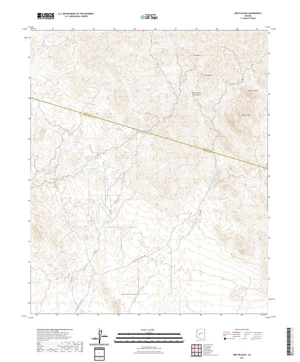
2021 Map of Red Picacho
USGS Topo · Published 2021About this map
Red Picacho stands as a prominent landmark within the southern extent of the Wickenburg Mountains, where the desert terrain is defined by a dense network of ephemeral watercourses. This modern topographic survey illustrates the transition between Yavapai Co and Maricopa Co, a region marked by volcanic peaks like Mt Pechan and Mt Vernon. The landscape is heavily dissected by drainage systems such as San Domingo Wash, Monarch Wash, and Trilby Wash, which dictate the local topography and historical movement through the area. Human infrastructure is primarily represented by rural corridors like N Castle Hot Springs Rd and N Mine Rd, providing access to the more secluded reaches near Tub Spring and White Picacho. This map offers a detailed view of the complex hydrography and elevation that characterize this part of the Sonoran Desert.
Find a feature on this map
20 named features on this map. Tap any name to fly to it.
Don’t see what you’re looking for? This feature index may not catch every label — zoom into the map to look around manually.
Map Details
Editions of this 2021 Red Picacho Map
This is the sole edition of this map. No revisions or reprints were ever made.
Other maps of this area

1887 · Prescott
USGS Topo · 1:250,000

1892 · Prescott
USGS Topo · 1:250,000

1903 · Bradshaw Mountains
USGS Topo · 1:125,000

1903 · Congress
USGS Topo · 1:125,000

1904 · Congress
USGS Topo · 1:125,000

1947 · Crown King
USGS Topo · 1:62,500

1947 · Wagoner
USGS Topo · 1:62,500

1948 · Crown King
USGS Topo · 1:63,360

1948 · Wagoner
USGS Topo · 1:63,360

1950 · Wagoner
USGS Topo · 1:62,500