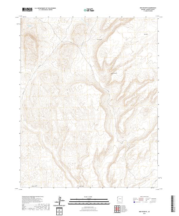
2021 Map of Red Pockets
USGS Topo · Published 2021About this map
Mojave Desert terrain dominates this Mohave County landscape, where water sources are vital markers for navigation and survival. Notable catchment features like Red Pocket Tanks and the perennial Cove Spring appear in the northern and western sections of the quadrangle. The desert topography is defined by significant drainage systems, including Pakoon Wash, Cedar Wash, and the winding Tom and Cull Wash which cuts through the high ground.
Find a feature on this map
15 named features on this map. Tap any name to fly to it.
Don’t see what you’re looking for? This feature index may not catch every label — zoom into the map to look around manually.
Map Details
Editions of this 2021 Red Pockets Map
This is the sole edition of this map. No revisions or reprints were ever made.
Other maps of this area

1886 · Saint Thomas
USGS Topo · 1:250,000

1886 · Mt. Trumbull
USGS Topo · 1:250,000

1892 · Mt. Trumbull
USGS Topo · 1:250,000

1893 · Saint Thomas
USGS Topo · 1:250,000

1926 · Bonelli
USGS Topo · 1:96,000

1953 · Gold Butte
USGS Topo · 1:62,500

1953 · Grand Canyon
USGS Topo · 1:250,000

1954 · Las Vegas
USGS Topo · 1:250,000

1954 · Littlefield 3 SW
USGS Topo · 1:24,000

1954 · Littlefield 3 NE
USGS Topo · 1:24,000