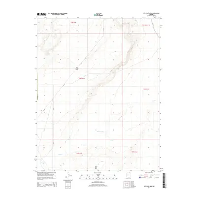
2014 Map of Red Point Mesa
USGS Topo · Published 2014About this map
Red Point Mesa and White Rock Mesa dominate this arid landscape in northern Apache County, where the terrain is defined by the shifting course of Tyende Cr. The water systems here, including Blackhorse Wash and the remote Tah nih choa ah Spring, reflect a sparse but essential network of life in the high desert. This 2014 survey documents the modern infrastructure of the region, specifically the Bureau of Indian Affairs routes such as Bia-18, Bia-6510, and Bia-594 that navigate the high plateaus and low washes. The map provides a precise look at the township and range boundaries across T37N through T39N, illustrating how traditional landforms and modern jurisdictional lines intersect in this corner of Arizona.
Find a feature on this map
15 named features on this map. Tap any name to fly to it.
Don’t see what you’re looking for? This feature index may not catch every label — zoom into the map to look around manually.
Map Details
Editions of this 2014 Red Point Mesa Map
This is the sole edition of this map. No revisions or reprints were ever made.
Other maps of this area

1883 · Marsh Pass
USGS Topo · 1:250,000

1892 · Marsh Pass
USGS Topo · 1:250,000

1892 · Canyon De Chelly
USGS Topo · 1:250,000

1952 · Dinnehotso
USGS Topo · 1:62,500

1952 · Agathla Peak 1 SE
USGS Topo · 1:24,000

1952 · Setsiltso Springs 2 SW
USGS Topo · 1:24,000

1952 · Setsiltso Springs 2 SE
USGS Topo · 1:24,000

1952 · Agathla Peak
USGS Topo · 1:62,500

1954 · Shiprock
USGS Topo · 1:250,000

1956 · Marble Canyon
USGS Topo · 1:250,000