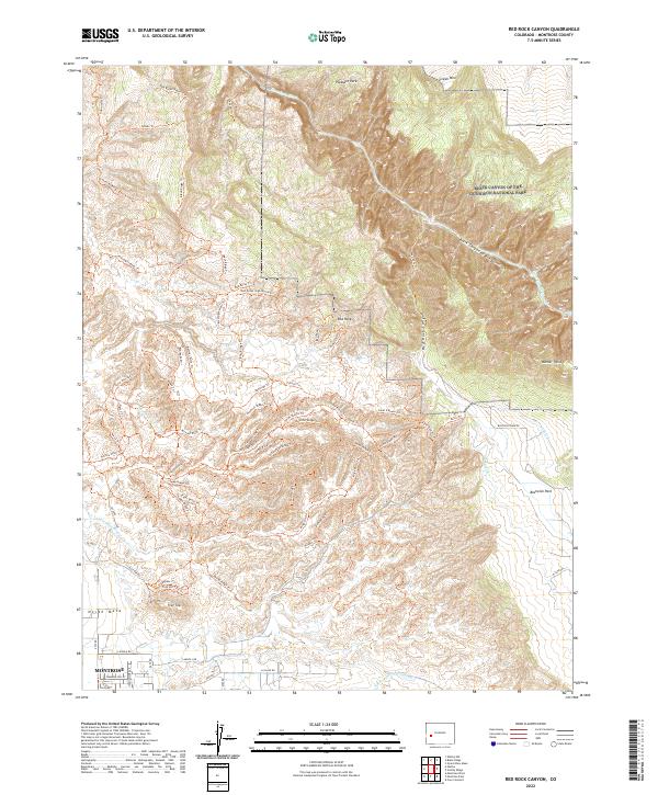
2022 Map of Red Rock Canyon
USGS Topo · Published 2022About this map
The Black Canyon of the Gunnison National Park dominates the northeast corner of this Colorado landscape, where the Gunnison River carves deep into the terrain. Below the canyon rim, a complex network of agricultural and mountain infrastructure supports the region, including the Loutsenhizer Canal and a dense system of historic ditches such as the Narrow Gauge Ditch Trl and Monster Ditch Trl. To the south, the city of Montrose marks the transition from the high plateaus of North Mesa and Flat Top to the settled valley floor. The map details an extensive trail system crossing unique geological features like Red Rocks and the heights of Green Mtn, reflecting the area's development for both resource management and modern recreation in the Uncompahgre Valley vicinity.
Find a feature on this map
71 named features on this map. Tap any name to fly to it.
Don’t see what you’re looking for? This feature index may not catch every label — zoom into the map to look around manually.
Map Details
Editions of this 2022 Red Rock Canyon Map
This is the sole edition of this map. No revisions or reprints were ever made.
Other maps of this area

1909 · Montrose
USGS Topo · 1:125,000

1911 · Montrose
USGS Topo · 1:125,000

1955 · Olathe NW
USGS Topo · 1:24,000

1955 · Black Ridge
USGS Topo · 1:24,000

1955 · Olathe
USGS Topo · 1:24,000

1955 · Red Rock Canyon
USGS Topo · 1:24,000

1956 · Montrose
USGS Topo · 1:250,000

1957 · Cerro Summit
USGS Topo · 1:24,000

1957 · Grizzly Ridge
USGS Topo · 1:24,000

1959 · Montrose
USGS Topo · 1:250,000