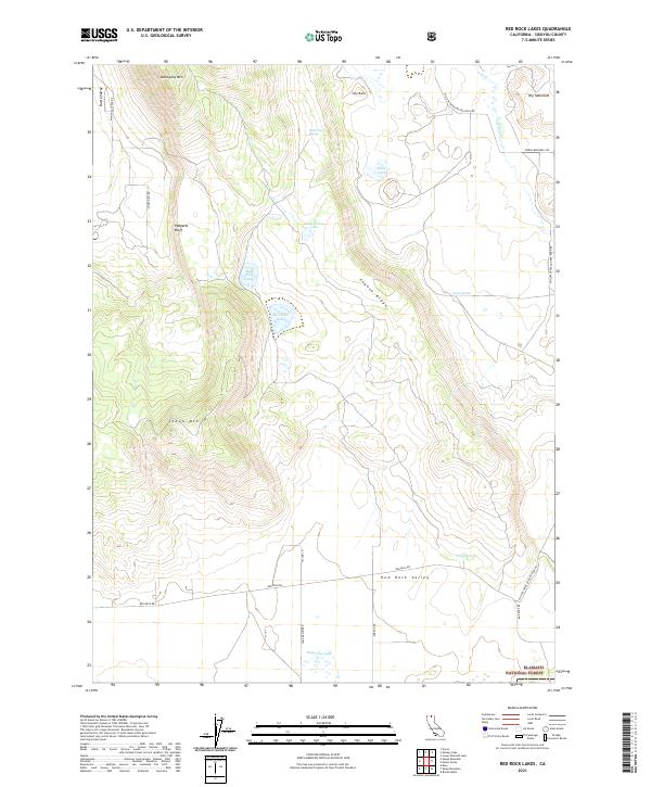
2021 Map of Red Rock Lakes
USGS Topo · Published 2021About this map
Red Rock Lakes and the surrounding high-elevation terrain of Siskiyou County are defined by a complex network of seasonal water sources and volcanic landmarks. This 2021 survey documents the transition between the Klamath National Forest and open ranchlands, where cattle management is evidenced by the Stock Trail Spring. The landscape is punctuated by prominent elevations including Mahogany Mtn, Sheep Mtn, and the distinctive Big Tableland.
Find a feature on this map
29 named features on this map. Tap any name to fly to it.
Don’t see what you’re looking for? This feature index may not catch every label — zoom into the map to look around manually.
Map Details
Editions of this 2021 Red Rock Lakes Map
This is the sole edition of this map. No revisions or reprints were ever made.
Other maps of this area

1886 · Modoc Lava Bed
USGS Topo · 1:250,000

1892 · Modoc Lava-Bed
USGS Topo · 1:250,000

1950 · Mt. Dome
USGS Topo · 1:62,500

1950 · Bray
USGS Topo · 1:62,500

1950 · Dorris
USGS Topo · 1:62,500

1952 · Medicine Lake
USGS Topo · 1:62,500

1954 · Alturas
USGS Topo · 1:250,000

1958 · Alturas
USGS Topo · 1:250,000

1962 · Alturas
USGS Topo · 1:250,000

1965 · Alturas
USGS Topo · 1:250,000