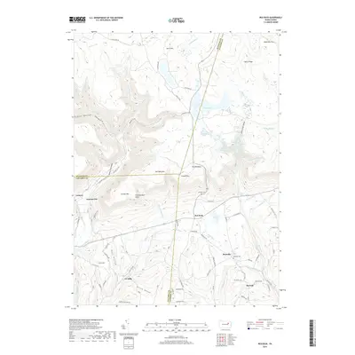
2019 Map of Red Rock
USGS Topo · Published 2019About this map
Jamison City and the small settlements of Red Rock and Mossville sit at the intersection of steep mountain terrain and creek-carved valleys in this modern survey of the Sullivan, Columbia, and Luzerne county lines. The landscape is defined by the dramatic drop-off from North Mountain, where high-altitude waters at Ganoga Lake and Lake Jean feed a series of spectacular cataracts, including Ganoga Falls, Seneca Falls, and Mohican Falls. These waters descend into the Fishing Creek Gorge, a corridor that historically supported timber and small-scale industrial interests.
Find a feature on this map
116 named features on this map. Tap any name to fly to it.
Don’t see what you’re looking for? This feature index may not catch every label — zoom into the map to look around manually.
Map Details
Editions of this 2019 Red Rock Map
This is the sole edition of this map. No revisions or reprints were ever made.
Other maps of this area

1891 · Harveys Lake
USGS Topo · 1:62,500

1893 · Harvey Lake
USGS Topo · 1:62,500

1894 · Shickshinny
USGS Topo · 1:62,500

1894 · Bloomsburg
USGS Topo · 1:62,500

1934 · Laporte
USGS Topo · 1:62,500

1946 · Shickshinny
USGS Topo · 1:31,680

1946 · Dutch Mtn
USGS Topo · 1:24,000

1946 · Sweet Valley
USGS Topo · 1:24,000

1947 · Stillwater
USGS Topo · 1:24,000

1947 · Benton
USGS Topo · 1:31,680
Featured Places
- Colley Township, PA
- Jamison City, Sugarloaf Township
- Red Hill, Fairmount Township
- Red Rock, Fairmount Township
- Tri Mills, Sugarloaf Township