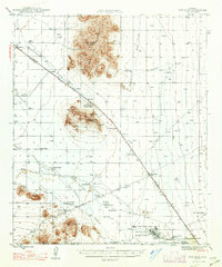
1947 Map of Red Rock
USGS Topo · Published 1947About this map
Picacho Peak and the Picacho Mountains dominate this mid-century landscape, serving as a dramatic backdrop for a corridor of transportation and agriculture in the Sonoran Desert. The Southern Pacific railroad and the Casa Grande Highway parallel one another through the Picacho Pass, connecting a series of rail-dependent settlements like Picacho, Wymola, and Red Rock. This era shows a transition from traditional ranching and mining to mechanized agriculture and military utility, evidenced by the numerous irrigation wells at Eloy Farms and Arizona Farms, alongside the Marana Basic Flying School. Local history is deeply rooted here, from the Old Sasco Ruins and Sasco Sch near the Santa Cruz River to family-held operations such as Kemper Ranch, Thompson Dairy, and the Bar V Lazy E Ranch.
Find a feature on this map
39 named features on this map. Tap any name to fly to it.
Don’t see what you’re looking for? This feature index may not catch every label — zoom into the map to look around manually.
Map Details
Editions of this 1947 Red Rock Map
2 editions found
Other maps of this area

1922 · Red Rock No 2
USGS Topo · 1:48,000

1922 · Signal Peak
USGS Topo · 1:62,500

1924 · Signal Peak
USGS Topo · 1:62,500

1934 · Tucson Mountains
USGS Topo · 1:125,000

1934 · Silver Bell
USGS Topo · 1:125,000

1934 · Newman Peak
USGS Topo · 1:125,000

1947 · Cortaro
USGS Topo · 1:62,500

1947 · Red Rock
USGS Topo · 1:62,500

1947 · Eloy
USGS Topo · 1:62,500

1948 · Eloy
USGS Topo · 1:62,500